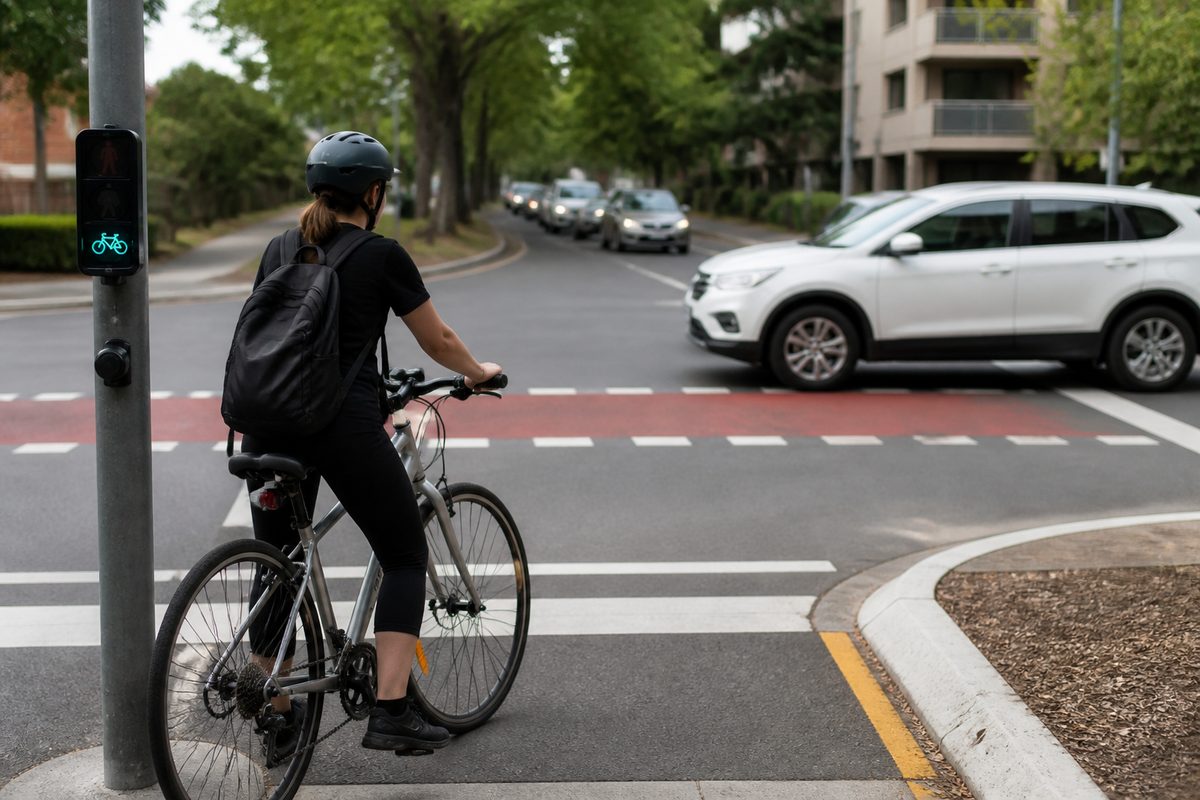
Cycling around Bayswater works well when you link its rail-side paths, quiet streets and river routes, but major roads still break the network at key crossing points. The area has useful pieces of Cycling infrastructure. The problem is that these pieces do not always join in a clear or comfortable way. A rider may enjoy several easy kilometres, then reach a fast road with no obvious crossing.
This guide covers Bayswater, Western Australia, with a focus on practical local trips. It explains how to plan around the Midland rail corridor, reach the Swan River, cross busy roads and spot the missing links before they interrupt a ride. It is for people riding to work, school, shops, parks or a train station rather than cyclists seeking a hard training route.
Which routes form the main cycling network?
The rail corridor is the strongest spine for cycling through Bayswater. Paths and lower-traffic streets near the Midland Line help riders move between Bayswater, Meltham, Maylands and areas closer to central Perth. This corridor is useful because it follows a direct line and connects with Rail transport at several stations.
The route is not one unbroken path with the same design from end to end. Some parts feel separate from Traffic. Other parts use local streets, station approaches or short links where riders must watch for turning cars. Follow the direction of the railway, but do not assume every section will look like a formal shared path.
South of the railway, Whatley Crescent and nearby streets provide access towards Maylands. North of the line, Railway Parade serves a similar east-west role. These roads can help when a path ends, though comfort changes with traffic speed, parked cars and the time of day. A confident adult may find them simple. A family with a child may choose a quieter street even if it adds distance.
The Swan River side of Bayswater offers a different type of ride. Local streets lead towards Riverside Gardens, Baigup Wetlands and the river foreshore. These areas suit slower riding and recreation. They also create useful links towards Maylands and other riverside destinations. Flooding, maintenance work or wet ground can affect low sections near the river, so a backup route through local streets is worth knowing.
The Tonkin Highway corridor provides another important north-south connection. Its paths can carry riders beyond Bayswater, but reaching them from a neighbourhood street may be less direct than the map suggests. Highway ramps, industrial access points and large junctions can place fast vehicle movements close to the cycling line.
How can a rider join these routes without using busy roads?
Start with the nearest low-traffic street, then join the main path as late as possible. This often feels better than riding a main road for the whole trip. The direct road on a map is rarely the best Bicycle route when it has narrow lanes, parked cars or frequent turning movements.
A useful plan has four parts:
- Choose the rail corridor, river path or highway path as the main spine.
- Find a quiet street that reaches that spine.
- Mark the safest legal crossing of every major road.
- Check where the path ends or changes sides.
This method prevents a common planning error. A digital map may show two paths touching a road at nearly the same point. On the ground, barriers, slip lanes or a median can stop a rider from moving between them. The true connection may sit 200 metres away at a signal-controlled crossing.
For a trip to Bayswater Station, approach choice matters. The station precinct is a major point where cycling, walking and Public transport meet. Riders should follow signed station access rather than making a late move across several traffic lanes. If the chosen entrance is awkward, continue to a controlled crossing and return on the correct side.
For a river trip, use local access streets to avoid long stretches on Guildford Road. The river may appear close, yet the rail line and major roads can sit between the rider and the foreshore. Plan the crossing first. The pleasant section beside the water should be the final part of the route, not the only part considered.
Which road crossings need the most care?
Guildford Road is one of the clearest barriers. It carries steady traffic and has several lanes in places. Cross at a controlled location where possible. A small saving in distance does not make an uncontrolled dash across a major roads worthwhile.
Tonkin Highway creates a wider barrier. Riders usually cross through purpose-built paths, underpasses or bridges linked to larger junctions. These facilities remove some direct conflict with through traffic, but ramp crossings still need care. Drivers entering or leaving a high-speed road may focus on a gap in vehicle traffic instead of a rider approaching from the side.
At every ramp or side road, reduce speed enough to check both the turning lane and the road behind it. Make eye contact only as an added check. It does not replace giving way rules or a clear view of the vehicle.
Local crossings near stations also deserve attention. A Traffic light can make a junction legal to cross without making every movement comfortable. Riders may face short signal phases, crowded waiting areas or turns across the path. Position the bike straight, watch the bicycle signal where one is provided and wait for the next phase if the holding space is full.
Roundabouts can be harder than signals because drivers scan for vehicles already circulating. A rider entering from the edge may be less visible. On a quiet roundabout, taking the traffic lane can make a confident rider easier to see. Less confident riders can dismount and use a suitable pedestrian crossing where available. Riding across a pedestrian crossing requires care and must follow the rules applying to that crossing.
Why do some connections feel unsafe even when a route exists?
A line on a map measures access, not comfort. A route may technically connect while forcing riders through a narrow pinch point, an unsigned turn or a crossing beside fast traffic. These weak points shape whether people will use the full network.
Good Infrastructure keeps the rider's task simple. It gives enough space, makes priority clear and lets drivers see riders before their paths cross. Weak design asks the rider to solve several problems at once. The rider may need to read a sign, change sides and judge a turning car within a few seconds.
A Protected intersection handles these conflicts by separating bicycle movements from motor traffic and controlling where each movement occurs. It may use corner islands, set-back crossings and separate signal phases. Bayswater has controlled junctions and separated path sections, but riders should not expect this full treatment at every large crossing.
Paint alone offers limited protection where vehicles turn at speed. The danger sits at the point where paths cross, not on the long section between junctions. This is why a short missing connection can matter more than a kilometre of good path.
Parked cars cause another comfort gap. A marked riding space beside parking can place a cyclist near opening doors. Leave enough room to avoid the door zone. If that requires moving into a traffic lane, check behind early and make the move in a clear, steady line.
Where are the missing links most likely to affect a trip?
Missing links often appear at the edge of a good facility. The rail-side path may finish at a station precinct. A river route may feed into an ordinary residential street. A highway path may reach a junction without a direct link to the nearby shopping area.
The most common gaps around Bayswater fall into four types:
- Major-road gaps: Two useful local routes sit on opposite sides of a road, but the safe crossing is away from the natural travel line.
- Railway gaps: The tracks limit north-south movement to selected bridges, underpasses and station connections.
- End-of-path gaps: A separated facility stops and places riders into mixed traffic with little warning.
- Information gaps: A connection exists, but poor Wayfinding makes it hard to find.
Information gaps are easy to dismiss, yet they change real trips. A rider who misses a turn may end up beside a highway ramp or on the wrong side of the railway. Clear Wayfinding should name major destinations, show distance and remain visible before the decision point. Signs placed after a turn offer little help.
Construction can create temporary missing links. Work near the railway, station or major roads may close a path or move it to the other side. Temporary signs should guide riders through the full detour. If signs disappear halfway through, follow the legal street network rather than entering a closed area.
How should different riders choose between the available routes?
A regular commuter will often value a direct line and predictable surfaces. The rail corridor usually fits that need because it connects stations and supports longer east-west trips. The best commuter route still avoids a stressful crossing where a short local detour removes it.
A family ride needs more separation from traffic and fewer complex junctions. River and park routes may suit this purpose, though the journey to the foreshore can include ordinary streets. Adults should inspect unfamiliar crossings before leading young riders through them. A route that feels easy to an adult can overwhelm a child who must watch several vehicle movements.
A person combining cycling with Public transport should plan around station access and bicycle storage. Riding to a nearby station can replace a car trip, but only if the final approach is clear. Check where bicycle parking sits before arriving. This avoids circling the station or carrying a bike through a crowded pedestrian area.
New riders should favour consistency over raw speed. A route with an extra five minutes on quiet streets is often easier to repeat each day. Repeated use builds knowledge of signal timing, driveway activity and busy periods. That knowledge reduces surprises without removing the need to stay alert.
Cargo bikes and bikes with child seats need wider turns and more stopping space. A narrow chicane or tight refuge may be passable on a standard bike but awkward on a longer cycle. Check barriers and underpasses before relying on a route for school transport.
How can you test a route before relying on it?
Ride it once outside peak time. This reveals path endings, crossing positions and steep ramps without the pressure of heavy traffic. Stop safely when the route becomes unclear. Do not make a sudden turn based on a phone prompt.
During the test, note four things:
- Where separation from motor traffic begins and ends.
- Which crossings have signals or refuge space.
- Where signs become unclear.
- Which sections may feel different in darkness or rain.
Then test the route at the time you expect to use it. School traffic can change a quiet street. Peak-hour queues can block crossings and driveways. A riverside path that feels open on a weekday may become busy with walkers during a sunny weekend.
Maps are most useful when paired with street-level judgement. Cycling directions can suggest a route, while satellite images may show path position. Neither source can confirm current construction, surface damage or sight lines hidden by vegetation. Treat the first ride as a route check rather than a race against the predicted travel time.
Carry lights even if the outward trip starts in daylight. Underpasses, tree cover and an unexpected delay can reduce visibility. Use a front light that helps others see you and a red rear light. Bright clothing can help, but visible road position and predictable movement matter more.
What changes would make Bayswater easier to cycle through?
The biggest gain would come from joining existing routes across the barriers that divide them. Long new paths have value, but small works at the right location can unlock routes that already exist.
Priority work should focus on protected crossings of major roads, clear links across the railway and safe transitions where separated paths end. Each project should be checked from the view of a child, an older rider and someone using a wide cycle. If any of these riders cannot understand or fit through the connection, the design has left people out.
Signal timing also matters. A crossing that makes riders wait through several cycles encourages risky choices and weakens trust in the route. Bicycle detection should work without requiring a rider to move onto a footpath or press a button placed beyond easy reach.
Maintenance is part of the network. Broken glass, sand and overgrown plants can remove much of the usable path width. Drainage faults can close low routes after rain. Reporting these faults with a photo and exact location gives the responsible authority a clear job to assess.
New projects should publish detours before closing a route. The detour must work for the same users as the closed path. Sending riders onto a fast road is not an equal replacement for a separated facility.
What should you do before your next Bayswater ride?
Choose one main route spine, mark every major-road and railway crossing, then test the full trip off-peak before depending on it. This single check exposes the missing links that a map can hide and gives you time to replace them with quiet streets, controlled crossings or a clearer station approach.