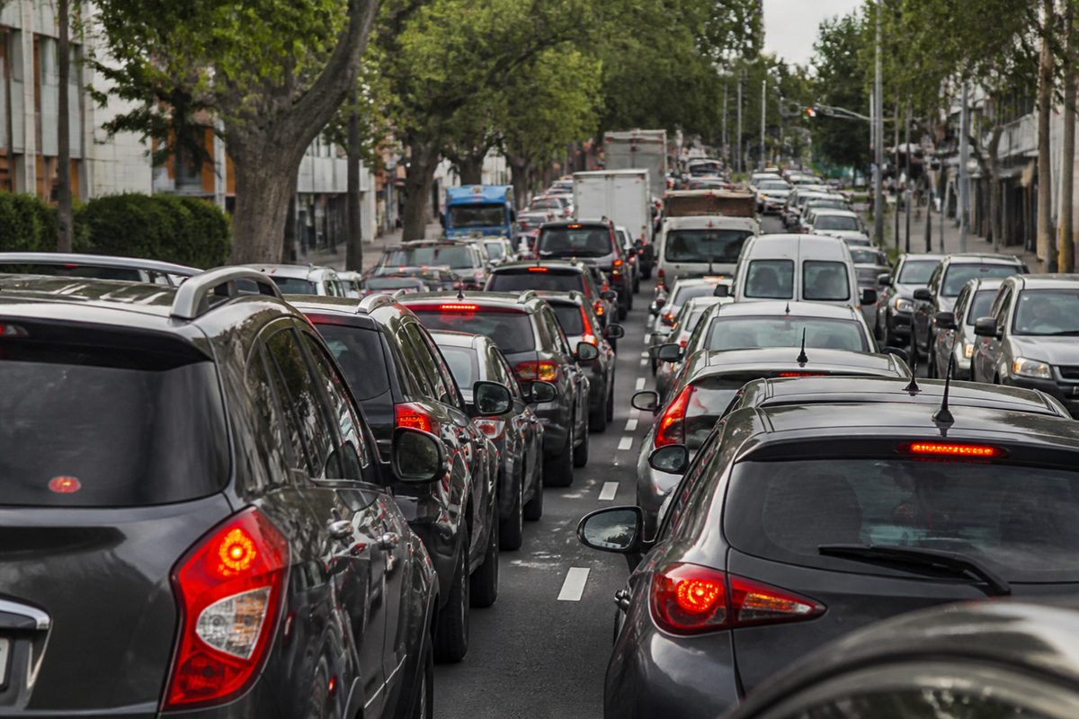
Bayswater’s worst delays occur where busy roads, rail corridors, station access routes and turning traffic compete for limited space. The exact trouble spots depend on which Bayswater you mean. Bayswater, Western Australia has a major rail junction near the town centre. Bayswater in Victoria has a busy road network around Mountain Highway, Bayswater Road and the industrial area. In both places, plans focus on moving more people through each junction rather than trying to fit an endless number of cars onto local streets.
Why do Bayswater traffic delays build so quickly?
Traffic congestion starts when demand reaches the limit of a road or intersection. A small event can then cause a long queue. One driver waiting to turn right may block a lane. A full station car park may send several cars back onto the street. school or commute peak junction. None of these events creates a major delay in light traffic. During rush hour, each one can push the road beyond its working limit.
The queue is often a symptom rather than the real fault. Drivers may see a slow traffic light and assume that longer green time will solve the problem. Yet extra green time for one road takes time from another road or from people crossing on foot. If the next junction is already full, releasing more cars can make the wider network slower.
Car dependency adds pressure because many trips begin and end in a car even when the destination is a train station, shop or workplace close by. More road space can ease one point for a time, but it can also attract extra traffic. Plans that improve rail transport, buses, walking and cycling seek to reduce the number of cars competing for the same space.
Where do delays form in Bayswater, Western Australia?
The main pressure in Bayswater, Western Australia sits around the town centre and the rail corridor. Bayswater railway station, Perth serves the Midland and Airport lines and acts as an interchange between trains, buses, walking routes and car trips. That makes the area useful, but it also brings several travel movements into a tight street network.
Queues can form on approaches to the station when drivers turn across traffic, stop for passengers or search for parking. Local traffic then mixes with people travelling through the area. A short queue at one intersection can reach the next side street and stop vehicles that are trying to move in another direction.
The rebuilt Bayswater railway station changed how roads and rail fit together. Raising the rail line and rebuilding the station removed the old low-clearance bridge constraint and opened space below the tracks. It also created a larger interchange that draws more passengers into the centre. The key test is therefore how well station access works at street level.
Pedestrians add another layer of demand. A train arrival can release many people at once. They may all reach a pedestrian crossing within the same minute. Signals must give them enough time to cross, while buses and cars wait nearby. This stop-start pattern is normal around a busy train station. Safe access matters more than keeping cars moving without interruption.
How does the railway shape traffic around the Perth town centre?
The Bayswater railway corridor once divided streets and concentrated movement at a small number of crossing points. A level crossing forces road users to wait whenever a train passes. Removing or separating that conflict allows road and rail movements to occur at the same time.
Grade separation does not remove every queue. It moves the limiting point. Once vehicles can pass beneath an elevated line, the next traffic light, turn lane or narrow road may become the new bottleneck. This is why transport plans must study the whole route rather than count only the minutes saved at the former rail barrier.
The same rule applies to station design. A wider road under the line may carry more vehicles, but poor foot access can lead passengers to cross in unsafe places. A well-designed pedestrian zone can guide people between platforms, bus stops, shops and nearby streets without forcing repeated conflicts with cars.
In my experience reviewing station precincts, the overlooked detail is often the kerb. Passenger drop-offs, deliveries, accessible bays and bus stops all want the same short section of road. Clear time limits and well-placed loading areas can prevent one stopped vehicle from blocking a live lane.
What do Perth transport plans propose around the station?
The broad plan is to treat the station as a transport interchange and town centre, rather than as a rail platform surrounded by car access. The rebuilt station and elevated Bayswater railway support more direct movement beneath the tracks. Precinct planning then has to connect that infrastructure to local streets.
Useful measures include:
- Direct walking routes between platforms, bus stops and the town centre.
- Safe crossings placed where people naturally walk.
- Protected space for cycling and secure bicycle parking near station entries.
- Managed pick-up, loading and accessible parking areas.
- Signal timing that responds to train arrivals and changing traffic demand.
- Clear bus movements that avoid repeated merging with general traffic.
A bus priority signal can give an approaching bus an earlier green light or hold a green phase for a few more seconds. This helps one bus carrying many passengers move through a junction without a large road expansion. It works best when the bus has a clear approach lane. If the bus remains trapped behind cars, signal priority has little chance to help.
Plans also need to stop station traffic from spilling into residential streets. Parking controls, safer walking links and dependable feeder buses can reduce the urge to drive to the platform entrance. The aim is fewer short car trips around the interchange, especially during the morning peak.
Where does traffic slow in Bayswater, Victoria?
Victoria’s Bayswater has a different road pattern. Mountain Highway carries traffic through the activity centre and links homes, shops, industrial sites and major north-south routes. Bayswater Road provides another important connection through the suburb. Their intersections and nearby access points handle through traffic as well as vehicles turning into shops, workplaces and side streets.
Delay grows where several lanes must merge or where right turns interrupt a steady traffic stream. Driveways can add friction because vehicles slow before leaving the road. Trucks need more time and space to turn near industrial properties. Buses stop and re-enter traffic. Each movement uses part of the road’s capacity.
The former Mountain Highway level crossing was a clear source of delay because road traffic stopped for trains. Its removal and the rebuilding of Bayswater station separated the rail and road movements. That removed one hard barrier, but it did not erase congestion from nearby intersections. Traffic can now reach the next signal sooner, where queues may still form.
Bayswater Road can also carry extra traffic when drivers seek a route around a slow section of Mountain Highway. Navigation apps can spread this traffic onto other streets. That may shorten one driver’s trip while adding noise, difficult turns and crossing risks for local residents.
Why can a removed level crossing leave nearby queues?
A level crossing removal cuts out one major interruption. It does not create unlimited space at the next junction. If a road previously discharged vehicles in groups after each train, nearby signals may have received natural gaps in traffic. Once the crossing is removed, cars can arrive in a steady stream. The downstream intersection must then handle that demand.
This effect can surprise drivers. They remember waiting at the rail gates and expect a completely clear trip after the project. What they find is a faster passage across the railway followed by a queue near a turn lane or shopping access point. The trip may still be quicker overall, even when the remaining queue feels more visible.
Signal coordination can help. Linked signals can release groups of vehicles at a speed the next junction can accept. Poor coordination does the reverse. Drivers leave one green light and meet a red light seconds later. Adjusting the cycle by a small amount can improve flow without widening the road.
A longer vehicle phase has a cost. People may wait longer at the pedestrian crossing, then take a risk when a gap appears. A sound plan measures total person delay and safety rather than judging success only by the number of cars that pass through.
What changes are proposed for the Victorian road network?
Plans for a corridor such as Mountain Highway usually combine intersection work, signal changes and better access to public transport. The strongest options target the cause of each queue.
- Longer or better-positioned turn lanes can stop turning vehicles from blocking through traffic.
- Coordinated traffic light phases can reduce stop-start travel between close intersections.
- Safer footpaths and crossings can make short local trips possible without a car.
- Bus priority signal treatment can improve reliability where buses lose time at busy junctions.
- Clear loading and driveway controls can reduce sudden braking and lane blockage.
- Rail transport improvements can carry more peak-hour travellers without adding the same number of cars.
Road widening is sometimes proposed, but it must be judged carefully. Added lanes can help where a short merge or turn lane causes a proven choke point. Continuous widening through a centre can make walking harder and may fill with new traffic. A targeted lane change often gives better value than a broad expansion.
The station area also needs safe links across major roads. A train service has less value to nearby residents if reaching the platform means crossing several wide traffic lanes. Short crossing distances, visible signals and direct paths can turn a difficult station trip into a simple walk.
How should residents judge a proposed transport fix?
Start by asking what problem the project measures. A plan designed to reduce car delay may shift waiting time to bus passengers or pedestrians. A plan designed around total person movement may accept a small car delay if it allows a full bus to pass sooner.
Check the location of the predicted benefit. An intersection upgrade can clear one approach while sending a larger queue to the next junction. Useful plans publish travel times across the full corridor and test nearby residential streets for added traffic.
Peak figures also need context. A project may save several minutes during rush hour and have little effect at other times. That can still be worthwhile, but the public should know when the benefit occurs. Average daily traffic alone can hide a severe 30-minute school or commuter peak.
Safety should remain a firm test. A proposal that removes a crossing or lengthens the walk to a station may discourage walking. People often choose the shortest path even when designers expect them to take a detour. Good plans place each pedestrian crossing on the route people already want to use.
Look for evidence that public transport measures can work in real conditions. A bus priority signal needs detection equipment, suitable signal timing and a path to the junction. A painted bus lane that ends before the queue may offer little gain. A protected approach that reaches the signal can save time on every trip.
Finally, check what is funded, what is proposed and what is only being studied. These terms describe different levels of certainty. Concept maps may show a desired network decades ahead. A funded project has a budget and delivery path. Residents can support a sound idea while still asking when it will be built.
Which approach is most likely to cut delays?
The best approach is a linked set of small, targeted changes backed by strong public transport. In Perth, that means making the rebuilt station easy to reach by foot, bicycle and bus while managing drop-offs and local traffic. In Victoria, it means improving the junctions around Mountain Highway and Bayswater Road while protecting access to the station and activity centre.
No single traffic light setting can solve car dependency. If nearly every new trip uses a car, each road improvement will face fresh demand. Rail, bus and walking upgrades give people another way to reach work, shops and the station. That frees road space for freight, service vehicles and trips that cannot shift modes.
Action takeaway: When reviewing any Bayswater transport proposal, trace one full peak-hour trip through every junction, crossing and station entrance, then support the option that moves the most people safely across the whole route.